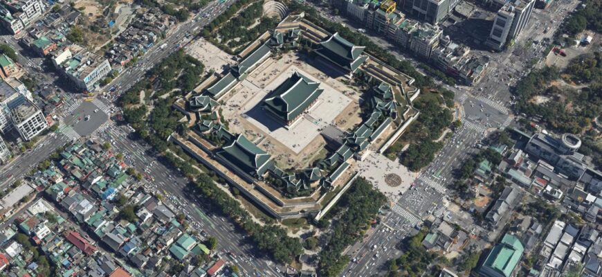
For almost twenty years, a quiet but intense tug-of-war has played out between Seoul and global mapping platforms. At stake wasn’t just cartographic pride or the occasional privacy complaint; it was national security, public safety, commerce, and the future of how people navigate the world. The story of South Korea forcing Google Maps to blur or obscure parts of its maps is an unexpected lesson in how governments, corporations, and citizens negotiate visibility in a digitized age. It’s about pixels, laws, and geopolitics — and how a nation that loves technology can still insist some things remain out of frame.
Maps feel simple: you type an address and the route appears. But behind that simplicity are layers of decisions about what to show, what to hide, and who gets to decide. In South Korea, these decisions have been shaped by a unique security landscape, domestic mapping alternatives, and sustained pressure from authorities intent on preventing potentially sensitive information from being displayed openly. As global mapping services expanded their coverage and resolution, the balance shifted into a confrontation that lasted nearly two decades and culminated in Google taking steps to blur or restrict certain imagery and map details to comply with local requirements. Read this post
- Why maps matter in South Korea
- Historical roots of the dispute
- Two decades of negotiation: a rough timeline
- What “blurring” or “obscuring” means in practice
- How different techniques compare
- Why Seoul pushed so hard
- Why Google resisted — and why it ultimately conceded
- Consequences: who wins and who loses?
- Broader implications: the geopolitics of cartography
- Practical tips for users in South Korea
- Conclusion
Why maps matter in South Korea
Maps are tools of orientation, commerce, and discovery, but they are also repositories of strategic detail. South Korea sits in a tense, long-standing geopolitical standoff on the Korean Peninsula. Military installations, missile sites, and critical infrastructure are not abstract points on a map; they are potential targets and sources of strategic vulnerability. That context makes the free availability of high-resolution satellite images and precise geospatial information especially fraught.
At the same time, South Korea is one of the most connected societies on the planet. People use mapping apps as an everyday utility — for public transit, deliveries, urban exploration, and business. Domestic mapping platforms have flourished precisely because they provide detailed, hyperlocal data adapted to local language and culture. So when the government asked global players to step back from showing sensitive sites in high detail, it didn’t just raise security questions — it raised practical ones about navigation, tourism, and the competitiveness of global map providers inside a demanding market.
Historical roots of the dispute
The confrontation didn’t spring up overnight. In the years after the Korean War and during the decades of unresolved tension with the North, Seoul developed laws and administrative safeguards designed to protect military facilities and other strategic assets. Those regulations required certain forms of geospatial data to be approved for dissemination. Initially, those rules were aimed at domestic photographers, journalists, or mapmakers, but the rise of global satellite imagery providers and multi-national map platforms complicated enforcement.
Global companies operating at scale often prioritize consistency and usability, publishing detailed satellite imagery and precise mapping data across many countries. That approach clashed with South Korea’s security-focused rules. Negotiations, legal reviews, and public discussions followed. Platforms tried technical workarounds and policy tweaks; governments asked for redaction and obfuscation; and citizens watched as familiar places on their favorite maps became fuzzy or absent.
Two decades of negotiation: a rough timeline
- Early 2000s: Mapping platforms increase satellite coverage and urban detail worldwide. South Korea tightens administrative control over aerial photography and publication of high-resolution images of certain sites.
- Mid to late 2000s: Local mapping companies gain market share by adapting to domestic regulations and offering richer local features in Korean language and context.
- 2010s: Public attention rises as global maps begin showing removable or blurred military locations. Calls for government action increase amid concerns about drones and accessible satellite imagery.
- Recent years: After years of back-and-forth, agreements and regulatory pressure lead to more consistent blurring and removal of specific areas on international mapping platforms operating in South Korea.
This timeline is deliberately general because the negotiation was iterative: proposals, technical changes, and legal interpretations evolved together rather than following a single dramatic turning point.
What “blurring” or “obscuring” means in practice
When you hear that a map has been blurred, several technical approaches might be in play. Obscuring can take the form of pixelation of satellite imagery, reduced resolution for selected coordinates, removal of labels, or altering vector data so that building outlines and facility names are missing or generalized. Some sites are replaced with generic icons or emptied of any imagery, while others are shifted slightly or covered with artificial textures to prevent precise geolocation.
How different techniques compare
| Technique | What it does | Trade-offs |
|---|---|---|
| Pixelation/Blurring | Makes imagery visually unusable at fine scale | Preserves general context but reduces analytical value |
| Resolution reduction | Delivers lower-detail images for sensitive areas | Better for UX but datasets remain less useful for precise tasks |
| Label removal | Removes names/placemarks for sites | Navigation still possible, but identification is harder |
| Data obfuscation (coordinate shifts) | Alters exact position data slightly | Makes accuracy unreliable for precise applications |
Each technique has implications. For citizens and businesses, blurring may be inconvenient. For national security, it reduces the risk that adversaries can use publicly available tools for targeting. For researchers, data obfuscation can be a headache; many scientific and urban-planning tasks require precise, verifiable geolocation.
Why Seoul pushed so hard
South Korea’s insistence on restricting certain map details stems from several practical concerns. First, there are straightforward military reasons: the existence, layout, and orientation of bases and installations can be sensitive. Second, the proliferation of consumer drones and affordable remote-sensing capabilities makes easily accessible satellite imagery more than a curiosity — it’s a potential tool for reconnaissance. Third, the government needs to remain consistent with broader security policy and international obligations. Lastly, public opinion and the political calculus around safety can push officials to take a stricter line, especially when local media highlight vulnerabilities.
Those motivations are not unique to South Korea — many countries balance openness with security — but the peninsula’s ongoing tensions make Seoul particularly cautious and persistent in asserting restrictions.
Why Google resisted — and why it ultimately conceded
For a company like Google, uniformity, detail, and trust in map accuracy are core product values. Customers expect to find places, see up-to-date imagery, and rely on precise navigation. Blurring parts of a map conflicts with that promise. Moreover, compliance with each country’s detailed mapping rules is technically complex and politically fraught.
Google’s resistance was therefore practical — and sometimes legal. But businesses operate under the jurisdictions where their services are used. When compliance becomes a condition of market access, and when local alternatives already dominate because they follow those rules while offering better local features, global players eventually adapt to remain competitive. In short, regulatory pressure, reputational concerns, and commercial incentives combined to make blurring a necessary compromise for Google and others.
Consequences: who wins and who loses?
The results are mixed. From a security perspective, targeted blurring reduces one vector of risk by limiting the easy visibility of sensitive sites. From an economic and user-experience perspective, however, there are costs. Tourists may find less information; delivery services and startups that rely on precise public mapping may need to rely on licensed data or local providers; academic researchers might need to request official datasets rather than relying on public platforms.
Local mapping companies often benefit, since they can provide compliant services tailored to domestic users and maintain market share where global services are constrained. Conversely, global platforms lose a bit of their universality and consistency, which can matter for products that rely on worldwide uniformity, like some autonomous systems or international navigation features.
Broader implications: the geopolitics of cartography
What happened in South Korea is part of a larger, global trend: maps are no longer purely benign utilities. They are instruments of policy and potential national-security concerns. Different countries are taking divergent approaches to what data is public and what must be restricted, and that patchwork creates both practical challenges and political friction. It also raises questions about who gets to decide what the world looks like: governments, corporations, or open communities.
Looking ahead, the rise of AI mapping, real-time sensors, and autonomous systems will increase demand for accurate, high-resolution geospatial data. That pressure could push states to refine their rules, push companies to innovate in how they handle sensitive locations, or encourage new licensing frameworks that balance security and transparency while meeting technical needs.
Practical tips for users in South Korea
- Use local mapping apps like Naver Maps and Kakao Maps for the most reliable, legally compliant local data and features tailored to Korean users.
- If you’re a business or researcher needing precise geospatial data, look for official government datasets or licensed providers rather than relying solely on consumer map interfaces.
- Be mindful of legal and ethical obligations when using satellite imagery or drone footage — local rules can be strict and penalties may apply.
- Keep an eye on updates from global platforms; map data policies can change through negotiation and technical updates.
Those pragmatic steps can help users navigate the practical consequences of restricted mapping while staying on the right side of the law.
Conclusion
The long-running dispute that led South Korea to compel Google Maps to blur certain areas is a reminder that even in a hyperconnected world, some things remain contested: the right to know versus the duty to protect. The compromise reached — technical obfuscation and selective redaction — is imperfect but pragmatic, reflecting the realities of national security, local market dynamics, and the limits of global uniformity. As mapping technology advances, this balance will keep shifting, and the map on your screen will continue to be a reflection not just of geography, but of politics, policy, and negotiated visibility.
If you enjoyed this dive into the geopolitics of mapping and want more stories that unpack technology, policy, and everyday life, visit https://themors.com/ for related articles, deeper analysis, and fresh perspectives on how the world’s biggest platforms are reshaping our view of the planet.


